2012 February 17
Here’s another version of the ATA map of the Galactic Center that I posted earlier. The data are completely the same; I’ve just put together all of the pieces to be able to render the map into a pretty, correct PDF. Tadaa!
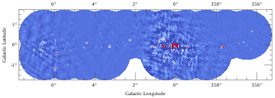
Look at how nice and text-selectable the labels are. Appreciate the lovely, colorblind-person-friendly colorization. Ponder the honoring of the image mask. Marvel at the lack of resampling of the underlying image data!
The only deficiencies that come to my mind are the excessively large margins and the lack of a synthesized beam size indicator. I had to wrestle with some unpleasant implementation details to get it all to work though. Like this. Time to call it a day.